
Earthquakes in Pakistan
Pakistan is located where the Eurasian and Indian tectonic plates meet. On average, Pakistan experiences 250 earthquakes with a magnitude above 4 Mw per year. In 2005 Pakistan experienced an earthquake of magnitude 7.6 Mw in the region of Kashmir, killing over 86,000 people.
Earthquakes and Empire in Pakistan
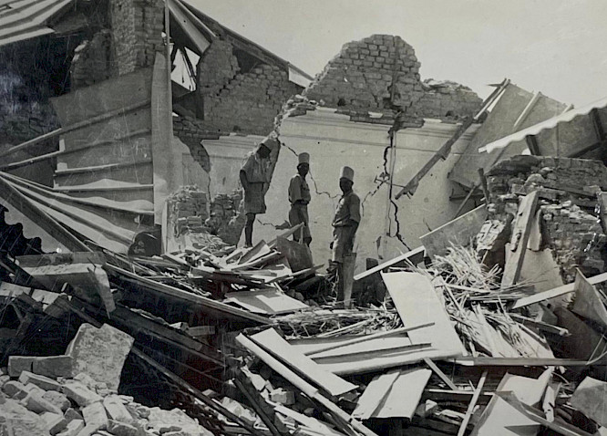
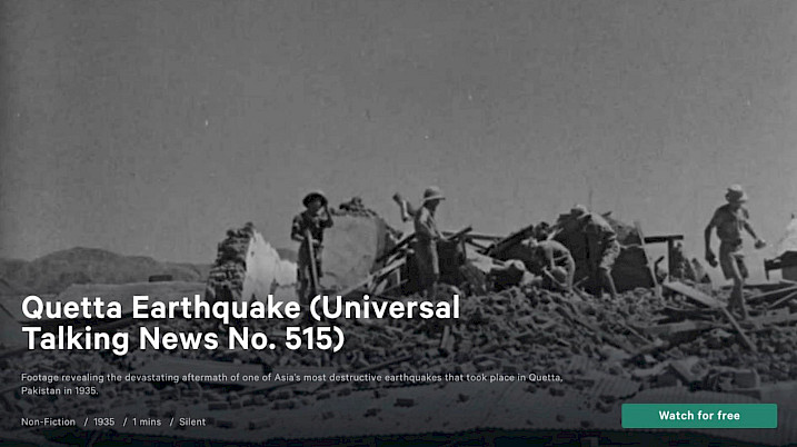
Pakistan was part of the British Empire, within British India, up until independence in 1947. In 1935 an earthquake with a magnitude of 7.7 Mw struck near the city of Quetta.
The earthquake struck at 3.03am, 31 May 1935. The main shock lasted around 3 minutes, but large aftershocks continued until at least 2 June 1935. Between 30,000 and 60,000 people were killed, over 14,000 homes were damaged, and local railway lines were damaged.
Responses: 1935 Quetta Earthquake
The British colonial army was mobilised and an emergency camp was established outside of Quetta. A health cordon was set up by the British colonial officials, in order to stop the spread of disease. Over 31,000 people were evacuated from the city of Quetta and a relief fund was established.
Over the longer term, the British colonial government established a new building code and began the reconstruction of the city. Insurance claims had to be assessed and paid.
Earthquakes After Independence
Pakistan gained independence from the British Empire in 1947. That same year, the independent government established the Geological Survey of Pakistan. Since 1947, Pakistani geographers have played an important role in understanding earthquakes and managing the risk of earthquakes. Pakistan received international aid to support the response to the 2005 Kashmir earthquake.
